WALLS AND ACROPOLISES

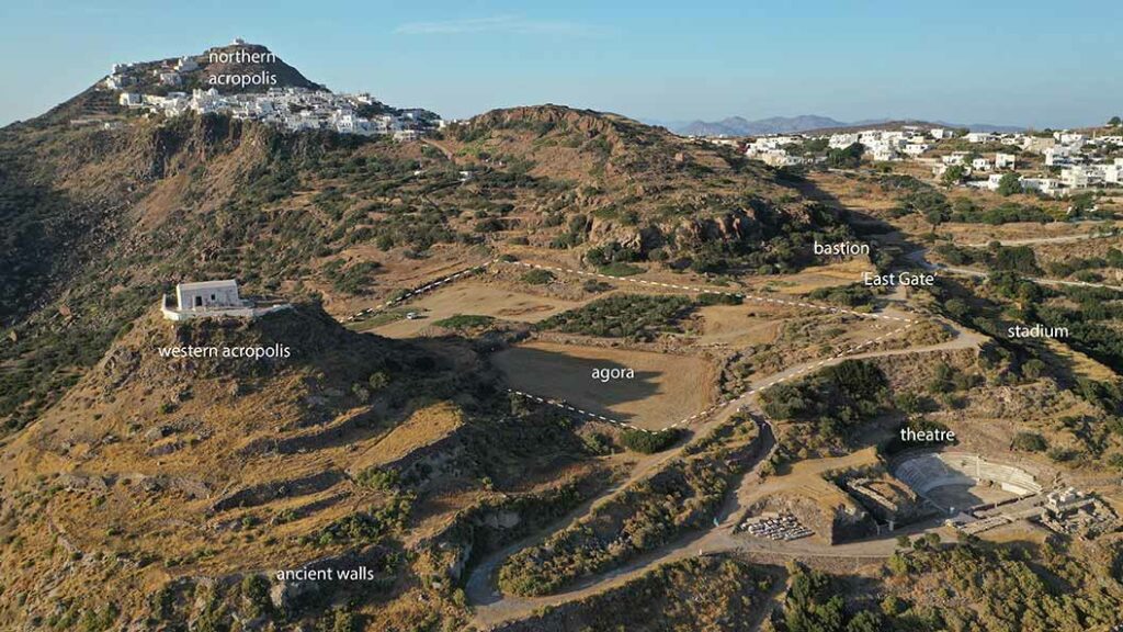
The ancient city of Milos was dominated by two acropolises: one to the west, on which stood a temple, and the other to the north-east, rising to a height of 198 m. The city was surrounded by imposing fortification walls, still largely visible, and preserved in places to a height of nearly 4 to 5 m, featuring several towers, bastions, and postern gates.


To cite this entry:

E. Le Quéré, B. Vergnaud, ‘Walls and Acropolises’, Philomilos.org, 2026, online: https://philomilos.org/ancient-sites/walls-acropolises/

Location of the two acropolises (view from the south)

(© Adobe Stock, with graphic modifications)

The western acropolis


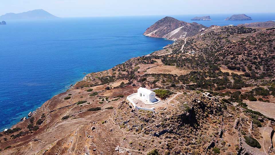
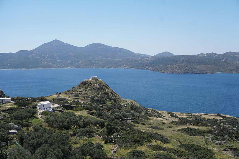
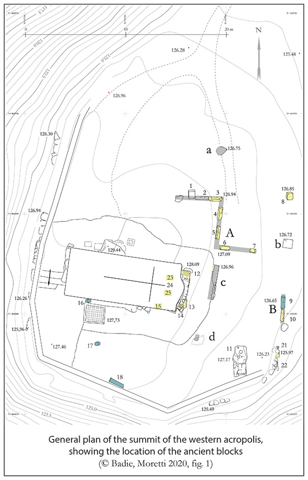
The western acropolis, now known as Prophitis Ilias hill, with its conical and steep summit, rises to 126 m. The small church of Prophitis Ilias stands on the site once occupied by a temple, of which archaeologists have uncovered several remains, including ancient blocks reused in the altar built into the chapel’s apse

Acropole-Ouest

The western acropolis with the church of Prophitis Ilias, built on the ruins of an ancient temple (view from the south-east)

(© Adobe Stock)

previous arrow
next arrow
Acropole-Nord

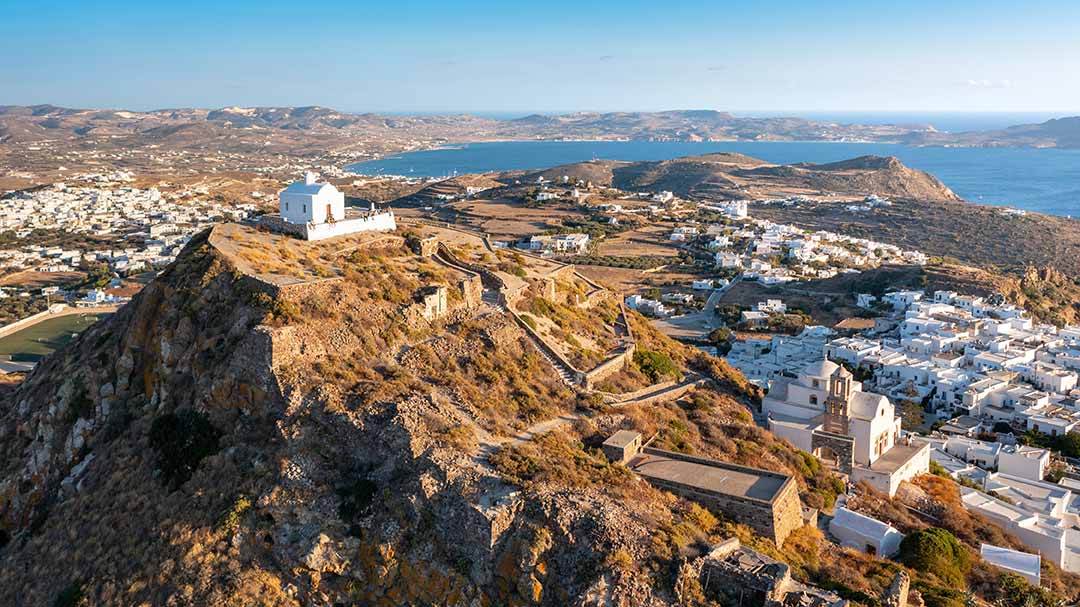
The northern acropolis, now known as Kastro (view from the north-west)

(© Adobe Stock)

previous arrow
next arrow

The northern 

acropolis

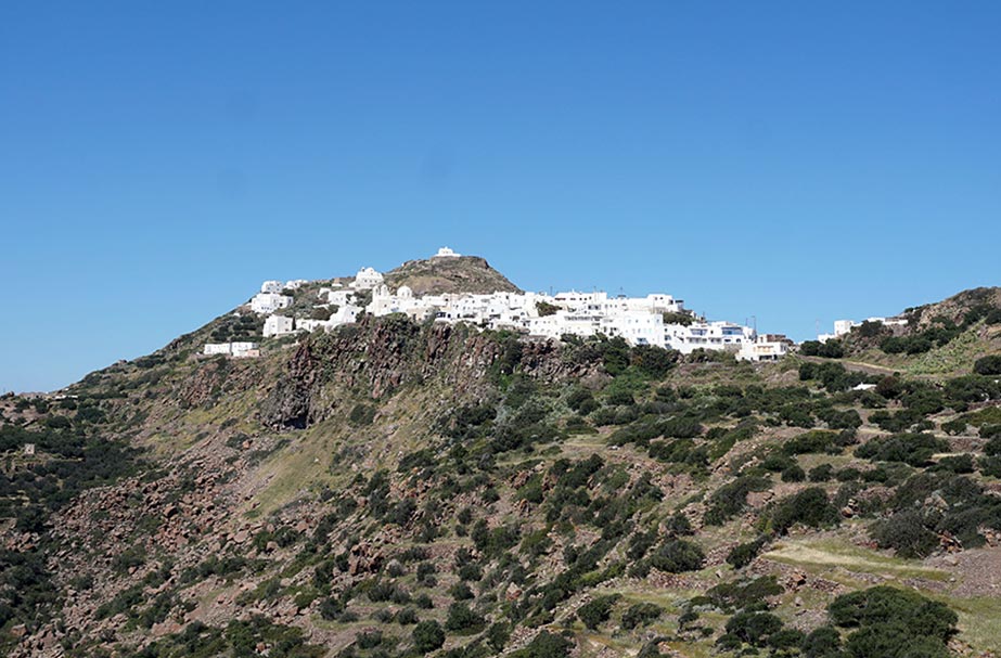
The northern acropolis, now known as Kastro (Castle), rises to 198 m. The Venetians largely reused the ancient remains to build their own fortifications there in the 13th century. At its summit stands the church of Mesa Panagia.

The

fortification


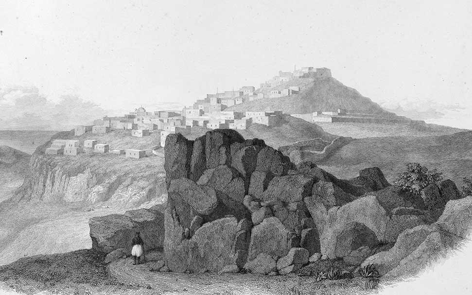
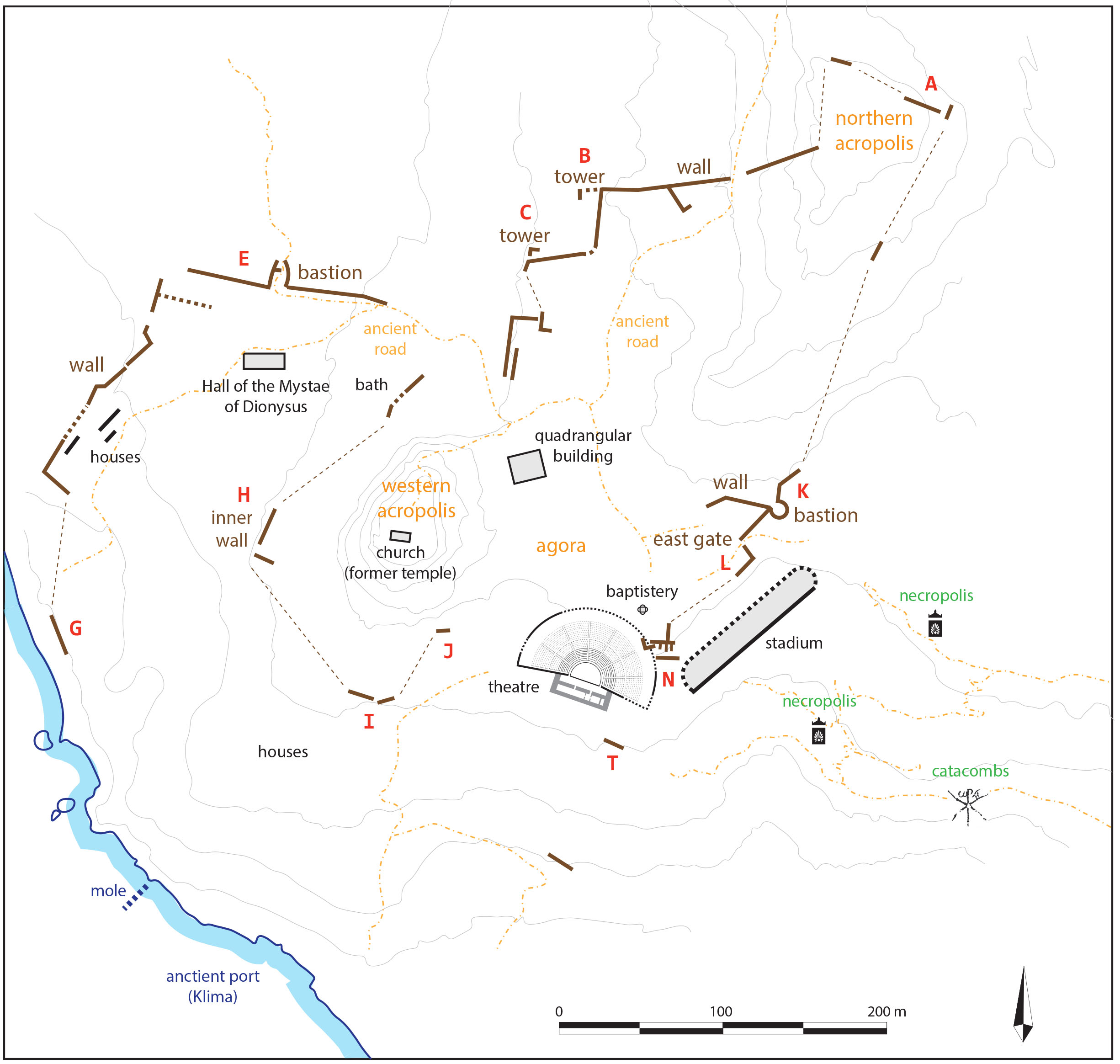
Although the sketches first published by Lecester (1852) and the plan published by Renfrew and Wagstaff (1982) are of interest, the details of the alignment, style, chronological sequence, and history of the ramparts remain to be studied. For now, the description can only be based on a general observation of the site, but a historical, archaeological, and architectural study of the city’s fortifications as a whole would need to be undertaken. Here is the description provided by Cherry and Sparkes (1982), p. 53–56 (see the plan):

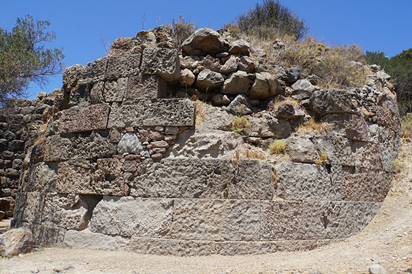
« Wall traces at (A) indicate that the [northern] acropolis was included within the circuit, the cliffs on the western slope obviating the need for built defences at this point. A finely preserved stretch of wall, built in a mixture of styles, runs steeply downhill past the church of Agios Phanourios, with outlying defensive corner towers further down at (B) and (C): there is also a projecting bastion at (E), and near here the entire width of the wall (approx. 4 m at the base) is preserved, rising to a height of 4 or 5 m. Just below the chapel of Agios Nikolaos, a short section of wall almost buried in slope debris […] provides indisputable evidence for the southward continuation of the defences at roughly sea level, but extensive remains at (H), (I) and (J) suggest a parallel circuit much higher up the slope of Prophitis Ilias [western acropolis]; whether the two systems were ever in use simultaneously is unknown. Preservation is much poorer on the east side of the town, but it is clear that fortification walls ran along the eastern slopes of the northern acropolis (K), where an impressively preserved circular bastion protects the approach to the ‘East Gate’ (L), w , excavated in 1895. The defences run above the stadium, turning at a complex corner arrangement (N) to plunge down the slope and fade from view. […] Slight traces downslope from the theatre (T) suggest a line running north-west along the lower flanks of the hill towards (G), thus leaving the lower town and the harbour immediately outside the circuit; but the defences were probably altered as the configuration of the harbour itself changed.”

Bastion

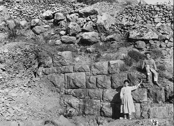
The circular bastion (K) near the “East Gate”, built with isodomic masonry (view from the south)

(photo: E. Le Quéré © Ministry of Culture – Ephorate of Antiquities of the Cyclades)

previous arrow
next arrow

Plan of the ancient city of Milos, showing the remains of the fortifications

(© E. Le Quéré, from Renfrew & Wagstaff 1982, p. 54 and Pandou et al. 2015, p. 4)

Excavations

Plan of the excavations carried out in 1895

(© Bosanquet 1896, p. 79)

previous arrow
next arrow

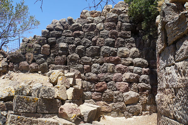
The fortifications enclosed the acropolises, the pass connecting them, and part of the flatter land in the Tramythia valley, including the agora. Their maximum extent was about 1,800 m (of which approximately 750 m remain visible), covering an area of around 15 ha. Two distinct styles, polygonal and isodomic, are easily identifiable – particularly at the “East Gate” – but their relationship and chronology are difficult to determine without more detailed architectural and archaeological analysis. The variety of styles may, however, indicate frequent repairs or reconstructions.

At the ‘East Gate’, probably the town’s main entrance, archaeologists uncovered the northern jamb and part of the door threshold still in situ at the end of the 19th century. From the outside, the gate is extremely well defended. Because of the steep drop in the ground on the south side of the road, anyone approaching the gate had no choice but to pass very close to the round tower, which thus effectively controlled the entrance. It was to the south of this entrance, in a niche or exedra, that the famous Venus de Milo was discovered in 1820 by a Greek peasant.

Further reading

Badie, Moretti 2020: A. Badie, J.-Ch. Moretti, “Milo : l’acropole (la colline du Prophète Élie) – 2017”, BAEFE, 2020, online, <https://journals.openedition.org/baefe/1942?lang=en>.

Bosanquet 1896: R. C. Bosanquet, “Excavations at Melos—The East Gate”, ABSA, 2, 1896, pp. 77–82.

Cherry, Sparkes 1982: J. F. Cherry, B. A. Sparkes, “A Note on the Topography of the Ancient Settlement of Melos”, in C. Renfrew, M. Wagstaff (eds.), An Island Polity: the Archaeology of Exploitation in Melos, Cambridge, Cambridge UP, 1982, pp. 53–57.

Leycester 1852: E. M. Leycester, “Some Account of the Volcanic Group of Milo, Anti-Milo, Kimolo, and Polino”, The Journal of the Royal Geographical Society of London, 22, 1852, pp. 201–227.